(in english) The Odyssey according to Gilbert Pillot
The Odyssey according to Gilbert Pillot
With these remarks, I took the trouble (and the pleasure...) to follow the route proposed by G. Pillot, with the help of the internet and especially Google Earth. The result is striking, the descriptions of the Odyssey crying out for realism in front of the proposed sites.
Everyone agrees that the composition of the Odyssey is disparate, from several sources and different eras. Of course for the form, but for the substance?
In fact, I am surprised that in this context it may be possible to find a coincidence with existing landscapes. It is remarkable that taking into account the speed of nine knots does not leave out any passage of the text. And we find on arrival landscapes corresponding to the descriptions of the Odyssey.
Let's resume the journey
2nd stage: a nine-day storm
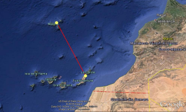
At nine knots, one travels 216 x 9 miles equals 1944 miles. Starting from Cape Malée, we arrive on a continent, in Morocco, potentially in El Ouatia, shortly after the Wadi Draa, in a country growing dates – the lotos? - And Kat?
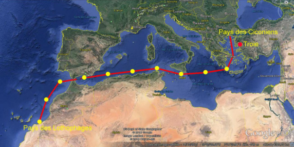
The question that comes to mind is: why go south out of Gibraltar?
The answer must be that of a true sailor: the southward inflection of navigation at the exit of Gibraltar, is due to the presence of a North current, the Canary current.
We will see in the rest of the story that the goal probably sought is the island of Eole (Madeira) The inflection towards the south of this path could be a warning of navigators which will have to take into account the North current at the exit of the Pillars of Hercules.
![]()
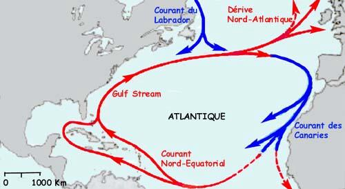
To return to the island of Eole, the route is punctuated by islands, and it is this path that Ulysses will take:
Reminder of the story of the Odyssey. :
Leaving the land of the Lotophagi, they arrive in the "land of round eyes" (The Cyclops).
In front of this island, a "Small Island": excellent land, forests, watered meadows, soft, suitable for vines and wheat. This island is populated only by goats.
Odysseus, leaving his troop there, goes to the main island with some warriors, to visit "a high cave", lair of a monster with one eye: Polyphemus.
The sea is wide open in front of Cape Juby.
But islands are nearby: Fuerteventura and Lanzarotte
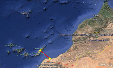
Here is an aerial photo of Lanzarote. It is tempting to call it the land of round eyes, the Cyclopia!
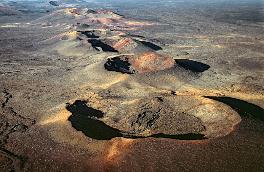
And in front of Lanzarote, as Ulysses describes it, a small island with a vast beach to run boats aground. It is difficult to access: shoals at the entrance of the bay are visible on the aerial view.
In the story of Ulysses. : "This island has in its port, holds so convenient that, without ashore the ships, they leave the ships. [....] That's where we come in: a god was driving us. »
(This mention "a god piloted us" is used in the Odyssey whenever there is a difficulty to fear: a valuable indication for navigation.)
The beach is still called today "la playa de la caleta", the beach of the hold.
(A "hold," in marine terms, is a gentle slope that allows boats to be launched.)
In addition, the island is wet and fertile, as in the description of Ulysses.
This is the island of Lobos
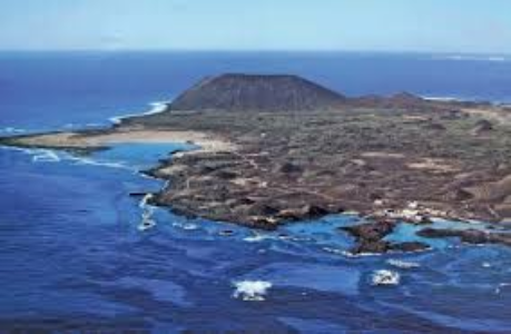
The descriptions of the Odyssey fit perfectly with these landscapes.
The quarrels with Polyphemus the volcano.
In the narrative, this interlude appears, which has the advantage of sustaining the dramatic interest and showing the malice of Ulysses. It is also an opportunity to justify one's misfortunes because of the resentment of the scorned Gods.
This episode has greatly inspired artists of all eras
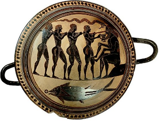
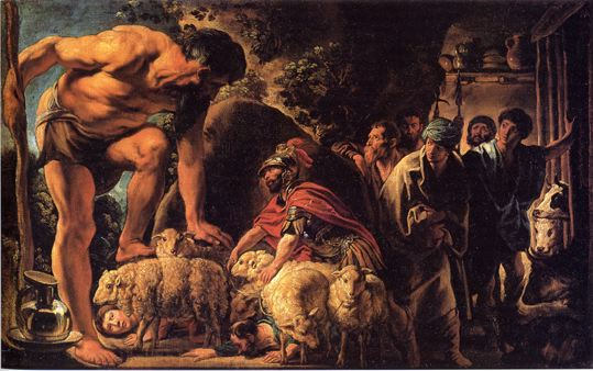
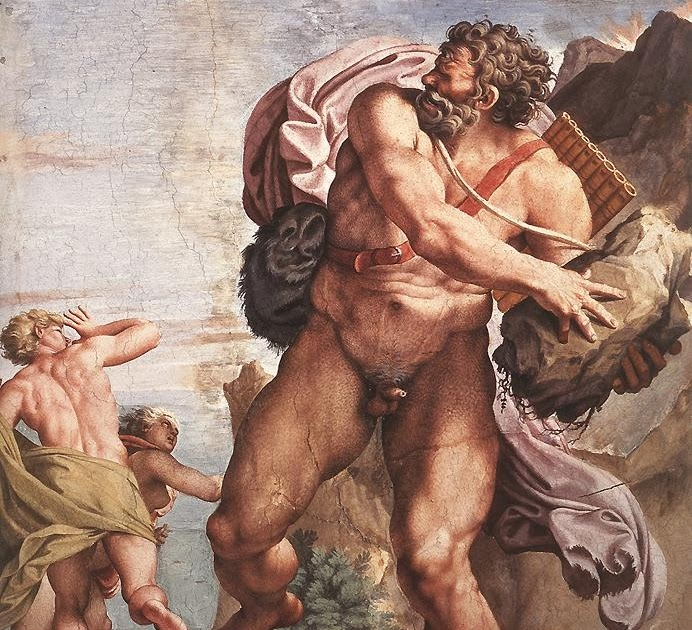
![]()
![]()
The torments inflicted on Polyphemus, son of Poseidon, offend the latter, who will pursue Odysseus with his vindictiveness, and cause him trouble; Poseidon is called the ground shaker and he is the god of the sea. : the Greeks thus made the connection between volcanoes and earthquakes.
After getting rid of Polyphemus, they leave again to reach the island of Eole: an island that floats, says the text, with bronze walls, a polished rock that points to the sky.
It is the portrait of Madeira, an island surrounded by currents, which can give the impression that it moves, therefore that it floats.
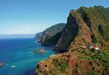
The crossing is not specified in its duration, but it follows the direction evoked by Aeolus, god of the winds (Eole = north-west direction)
Odysseus and his companions well received by the God of the winds, who offers Odysseus a bag containing the contrary winds.
When they leave, after a month's stay, they intend to return to Ithaca. The wind that takes them is "the breath of a Zephir", west wind. So they go east.
The journey lasts nine days, then the companions of Odysseus open the otter containing the winds,
and a new storm brings them back to the island of Eole.
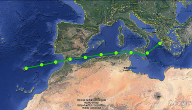
Again, the story is consistent with the speed chosen: the route Eole – Ithaca is 1896 miles, or 8.8 days at 9 knots
It is this round trip that shows that the meaning of this maritime relationship hidden in the Odyssey is to go first to the island of Eole (Madeira).
The story insists: after the involuntary detour due to the current, this is where we must arrive for the rest of the trip.
And why Madeira? Probably because this island is at the latitude of the entrance to the Mediterranean; so easy to find and find along the parallel using the tracking of the height of the Sun.at noon, the highest point of the Sun in the day.
This height is easy to control with rustic means: Jacob's stick or even just the outstretched hand.
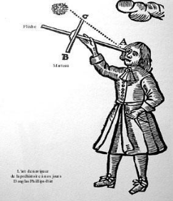
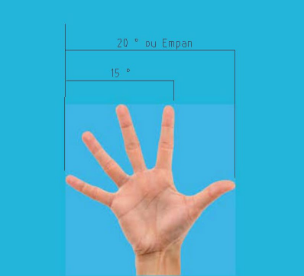
It is easy to see that 15° (angular distance between the little finger and the index finger) corresponds to the movement of the sun for 1 hour.
On their return, Eole considers that they are cursed by the Gods, and no longer wants to host them.
So they leave the island of Aeolus, to sail six days and six nights.
On the seventh day they arrive in the Lestrigon country.
In this country, the nights are short: the shepherd who leaves with his flocks greets another shepherd who returns.
The days are long: a brave man could earn double salary.
We must therefore look north for this point of arrival.
Let's keep the speed of 9 knots; a sailing of six days and six nights at 9 knots it makes a journey of 1296 miles (we arrive in Ireland) The seventh day arrives at the port (+88 miles for Killybegs).
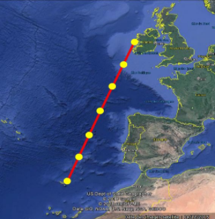
The port, "well known to sailors", is encased between two cliffs and very elongated.
The Lestrigons are in a bad mood and throw stones at boats.
The fleet is destroyed, only Odysseus' ship escapes.
Several sites may correspond to the description in this place of the coasts of Ireland
The Leenaun website
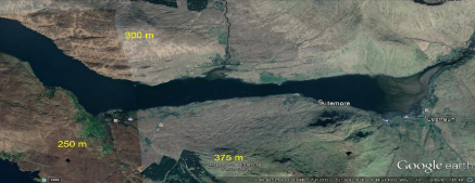
"A valley encased between two mountains". In the account of the Odyssey, the port is called Lamos. Sound to be compared to Leenaun?
Or in Mayo County
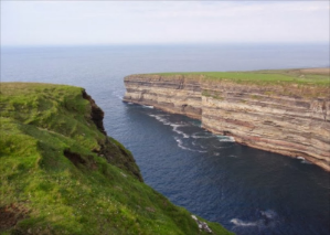
"A double cliff, steep and without cuts, stands all around"..
.Or rather Killibegs, still today an important fishing port.
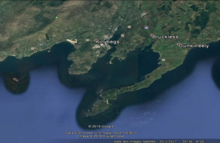
"Two elongated capes, which are opposite the front of the entrance, protect the mouth"
The Lestrigon country would therefore be the north of Ireland: Here is a country where, in summer, at this latitude, the days are long and the nights are short.
There is a site corresponding to the description made by the Odyssey.
And at a distance of six full days of sailing from the island of Eole (with our speculations already confirmed on the speed of the ships of 216 miles per 24 hours)
The island of Circe
In Greek mythology, Circe is a fearsome witch.
In the story of the Odyssey, she lives surrounded by animals, which makes her assimilate to Artemis the huntress. The encounter with a ten-horned deer is probably an allusion of this order. Is this also an indication of direction?
Ulysses and his remaining companions, leaving the other destroyed boats there, reach the island of Aiaié, home of Circe.
There, from the summit near the anchorage, we see a low plain surrounded by sea on all sides.
Travel to the island of Circe
G. Pillot imagined her as Bara, and searched unsuccessfully for possible traces.
It could rather be Tiree (Hebrides), in the direction suggested by the allusion to Artemis with the encounter with a deer. (Northeastbound)
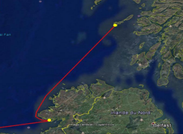
This island is part of Scotland:
A view of Tiree Island
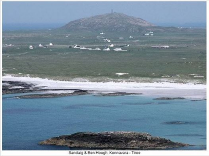
It is very close to the description: a flat island, and a promontory that allows you to see in the distance. But the one described by Ulysses was wooded. However, local archaeologists in Tiree believe that this was indeed the case in those remote times.
The beach of Balephuil which is the first that comes from the southwest is located between two heights: Kennavara (fifty meters above sea level) and Ben hynish (130 meters), which prevents you from seeing west and east ("neither the point of the noroit nor that of the dawn") from the beach (page 685). Ulysses complains! (Kennavara would be "the cape" and Ben hynish "the lookout" - where a radar, "the golf ball, is currently installed")
An additional reason: when describing the return trip, Circe indicates the island of the Sirens as a landmark, but not Tyree who would nevertheless be on the way from Bara.
And another curious clue: recent excavations on Tyree have highlighted a Bronze Age site, at a place called "Circeabol"!
Circe
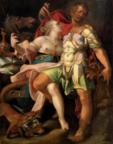
Circe the witch transforms part of the crew into swine by giving them a drug (the ancestor of Whiskey?)
Ulysses goes to see Circe to retrieve his crew. She tries to drug him in turn, but Hermes has given the antidote to Ulysses.
Circe and half the crew
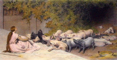
Circe hands Ulysses a drug, but Hermes pours the antidote
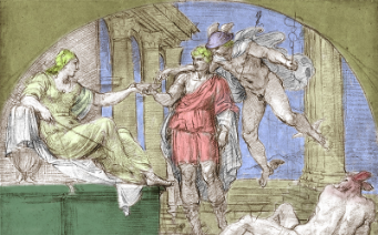
The charms of Circe
The underworld, in the land of the Cimmerians
After winter, spring returned, Circe told Odysseus to make a trip to the Underworld, to consult the soothsayer Tiresias who was there.
The journey begins with Boreas, the north wind (thus to the south), and continues as long as the day lasts until the confluence of several rivers of the underworld (the Acheron and the Pyriphlegethon, the Styx and the Cocytus). It is the land of the Kimmerians "covered with clouds and mists"... "Located in Noroi" (North West)
Ulysses meets many disappeared there.
Journey to hell
When one comes from Tiree (90 miles, or 10 hours at 9 knots), all the indications of the text agree: distance, direction taken, entry into a river, or in what one can take for such. A country covered in clouds and mists: Northern Ireland fits the description.
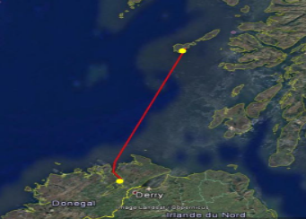
"goes to the places where the two rivers meet... »
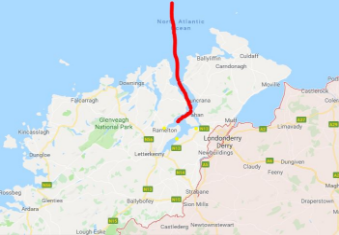
I think that the inlets of the abers can easily be mistaken for rivers, especially with a receding tide.
Returning from the Underworld to Circe, Ulysses considers the return journey.
Circe warns him against the Mermaids, birds with charming voices.
Supposed route
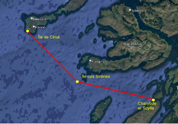
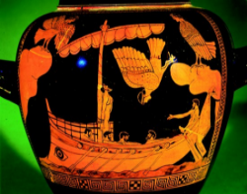
Ancient mermaids
Could the island of mermaids be an island laden with birds, Easily spotted from the sea?
And the "bleached bones" of guano? With the sui generis smell?
Ancient mermaids were birds
with charming voices.
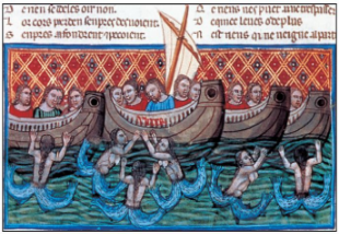
In the Middle Ages
Then they became fish-women
More recently
Then charming women
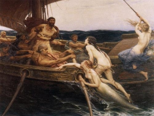
It is not the ears that
should have been plugged.....
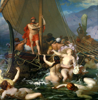
Then Back to navigation !
Circe described two routes to Odysseus:
1/ The Stones of the Pinnacle, exposed to the ocean. Only the Argo was able to pass these pitfalls.
2/ The two pitfalls of Charybdis (which swallows black water...) and Scylla (which shelters a monster)
Charybdis and Scylla
In the supposed direction, the route passes between the island of Scarpa, with its steep coast, and the north of the island of Jura with the lower coast: this corresponds to the description of the Odyssey.
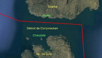
« ... We see the divine Charybdis engulfing the black wave: she engulfs and vomits three times every day.... »
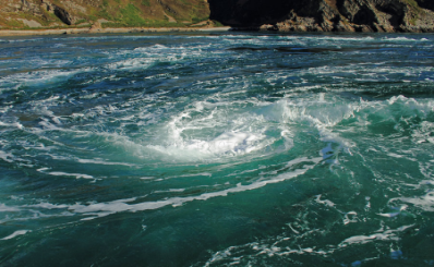
This photo is the reality of the Corryvreckan Strait.
This table is the tides in summer at this strait, visualized by a navigation software: there are two high tides and one low tide (or two low tides and one high) in a day (the days are long at these latitudes)

And it is true, as Circe specifies, that one is safer along Scarba -Skylla. (Oh, how similar these names are)
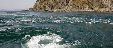
This strait leads to the island of Jura, where three aligned peaks (the three paps) strongly suggests the name of island "with three points" (Trinacrie).
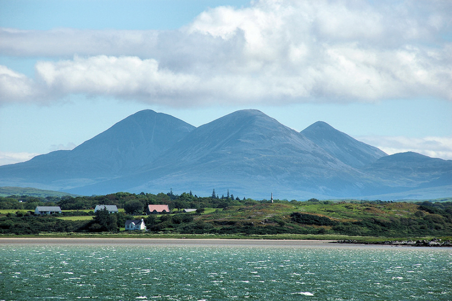
Precisely, this is what the Odyssey tells us:
Tiresias : "as soon as you escape the purple sea, your solid ship will put you on the shores of the island of Trident" (or Trinacria, or island of the Sun, in reference to Apollo).
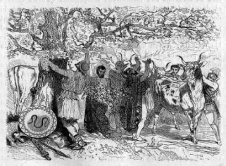
There are herds of cows and sheep, which must not be touched (They belong to the Gods).
The descriptions of the Odyssey have been translated into images by many artists... with cows whose horns are lyre-shaped, in reference to the lyre of Apollo.
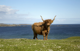
And what can we find on the island of Jura? Scottish cows...
The boat is blocked by the south (Notos) or east (Euros) winds, which prevent it from taking to the sea.
The companions of Ulysses, driven by hunger, kill an ox of Apollo.
The Gods are angry and punish the offenders: the ship is shipwrecked.
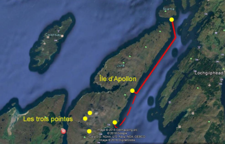
It is clear that the inlet along the island of Jura is oriented North East / South West, and that potential shelters are likely to be blocked by the south and east winds.
Struck down by Zeus for having killed the oxen of Apollo, and now without companions, Odysseus passes the pitfalls of Charybdis and Scylla, and drifts for nine days, clinging to the wreck of the boat. He arrives on an "ocean island": the land of Calypso.
Problem: we had the scale of the speeds of movement of the boats swept away by the storm, or in navigation: about nine knots. On the contrary, it is a drift, hanging on a wreck.
But, rereading the text of the Odyssey, we find a strangely similar passage, where a comparable adventure happens to Ulysses: nine days of drift on a wreck, but this time we can determine the points of departure and arrival.This is happening in the Mediterranean.
Various considerations (see Gilbert Pillot's book) conclude a drift of 1000 km, in a north-west direction (heading 330). This, shown on the map, at the exit of the Corriewreckan Strait, leads us straight or almost to the south coast of Iceland.
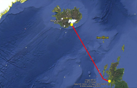
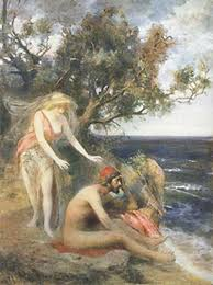
Ulysses has only a cap on his head.
He describes an astonishing, fertile and green country: Iceland remains likely.
He will be held back by Calypso for more than a year, but the Gods send Hermes to tell Calypso to let him go.
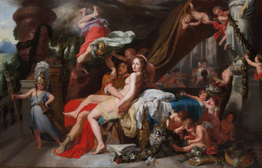
(When Hermes leaves Olympus to go to Calypso, he passes over Pieria.
Pieria is north of Mount Olympus, residence of the Gods.
The direction to reach Iceland passes through there, unlike the way to Gibraltar, Bérard's hypothesis.)
Aided by Calypso, Ulysses of a thousand tricks builds a boat to return to Ithaca
The trip lasts seventeen days!
The departure from Calypso's begins towards the south: "He looked at the Pleiades and the Bouvier"
These constellations are located in the South...
Then goes east: "we must keep the Big Dipper on the left"
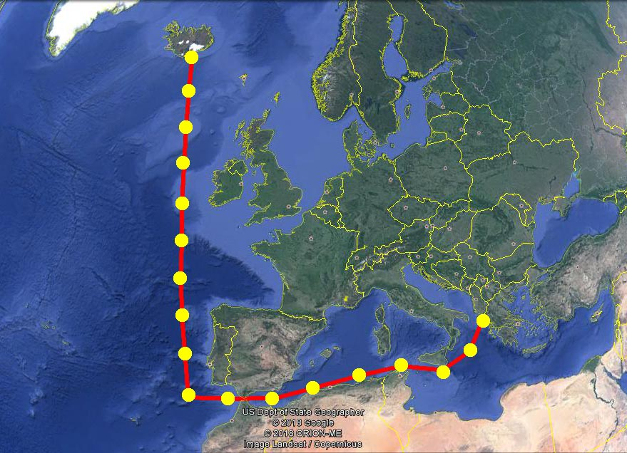
The hypothesis of nine knots of speed still holds!
And the other itinerary evoked by Circe?
"...The Stones of the Pinnacle, exposed to the ocean. Only the Argo was able to pass these pitfalls."
From the island of the Sirens, the road "exposed to the Ocean" is well in front of the Atlantic Ocean, where the disturbances from the West come from, with a leeward coast full of pitfalls, which sailors hate, especially on a boat likely to drift.
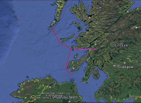
These roads seem to meet perhaps to Wales, and its tin mines. But the rest of the story was lost.
What "coincidences" that these correspondences of the sites with the text, with directions indicated by the bearing winds, and road times that follow the hypothesis of the nine knots!!!
But I don't think it's possible to find "concrete evidence" of these "coincidences." For the reason that the story of the Odyssey would be, according to G. PILLOT, only the pretext for the oral conservation of a maritime trade route, which moreover could very well have been incorporated by this hypothetical Homer well after the evocations of the peregrinations of Ulysses.
. Because this relationship draws in a logical (and marine) way a route to fetch gold from Ireland and tin from Wales.
The absence of evidence will keep this interpretation hypothetical.
Except perhaps with the tomb of Elpenor, the sailor who died in Circe's manor and met during the expedition to the underworld, which is said in the Odyssey was erected on the nearby cape: Should careful excavations be undertaken to find an urn containing Elpenor's ashes, and his burnt weapons? There is a pile of stones on Cape Kennavara that could be the tumulus "at the highest point of the cape?"
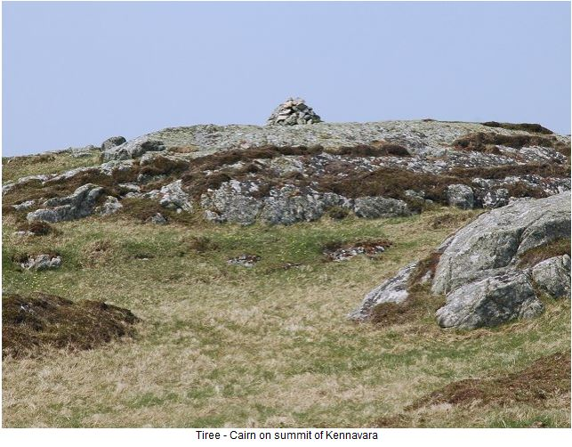
The fact remains that these "coincidences" leading to a coherence of Ulysses' relationship raise questions, and in my opinion deserve to be considered and studied, and not rejected in the name of poetry.
A découvrir aussi
- (in english) The Iliad and the Odyssey
- (in english) The Hellénist Victor Bérard
- (in english) Different interpretations & Speed of boats
